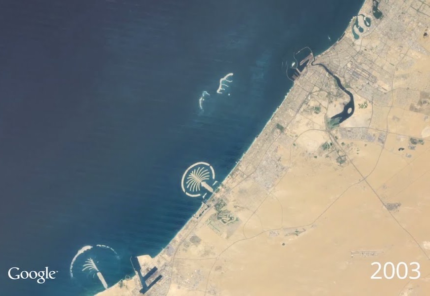
Google continued to push the boundaries of tech this week, when they unveiled their latest Timelapse update. After introducing the feature more than four years ago, the company is now releasing an updated version, showing us just how the earth has changed over the last thirty years. The process utilizes millions of satellite images from all over the world, and stitches them together to form an animated timeline. Just like its companion tech, Google Earth, the new Timelapse project allows you to view any location in the world.
The most striking examples of the software, are urban areas, where users can see the development of skylines and monolithic buildings. Human growth is quite apparent in Timelpase’s 32-year snapshots, and a perfect showcase of this, is the city of Dubai. The Emirates have seen an incredible topographic change since the 1980s, including more and more man-made islands. You can check out Google Earth’s own YouTube video of the populous UAE city.
To play around with Timelapse, you can visit the engine here. Alongside the foundation of one of the world’s most beautiful cities, there are a whole ton of other interesting visuals to explore. If you’re looking for examples, you can watch the steady completion of Oresund Bridge in Scandinavia, or watch the Shanghai Tower rise to become one of the largest structures in the world. Thankfully, you don’t have to sit in front of the screen for very long, as each Timelapse video only requires ten seconds of your time. If you’re feeling extra fancy, you can try your hand at a recorded version of the Timelapse by visiting the generator over here. There are endless opportunities, and if you’re a map buff, this is pretty much the ultimate tool to play around with. Just don’t blame us if you lose a few hours of your day.


